
Paddling Madison’s Wingra Creek
Once known as Dead Lake when European settlers believed it had no outlet and originally called “Ki-chunk-och-hep-er-rah” – the place where the turtle emerges – by the Ho-Chunk, Madison’s Lake Wingra is almost entirely surrounded by public land, and in a canoe in the middle of it the surrounding trees almost make the Madison city skyline disappear completely. The name Wingra means “duck” in the Ho-Chunk language an was officially applied by state legislature in 1855. Unlike Lakes Mendota and Monona (and on farther to Waubesa and Kegonsa), the diminutive city lake isn’t on the Yahara River.
Fed by springs and runoff/surface seepage, Lake Wingra connects east to Lake Monona via Wingra Creek, also known as Murphy’s Creek, but originally called Penora, “The Good Body,” by the Ho-Chunk. A paved bicycle trail follows the length of it, and for paddlers, the creek itself makes for a pleasant river outing without leaving town.
Tip and I took our canoe and put in near the Lake Monona boat landing at Olin-Turville Park on a Sunday afternoon. While the double-sized parking area seems more than adequate, the popularity of the fee-based boat landing for anglers can cause the lot to fill it up quickly on weekends. We used an unimproved shallow put-in rather than the concrete entry point in the lot nearest the boat ramp, which technically still requires a user fee even for silent-sport paddlers.
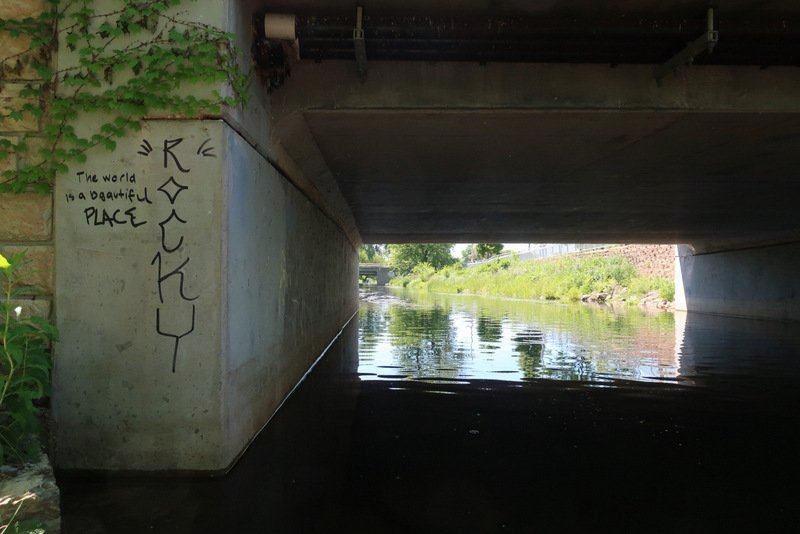
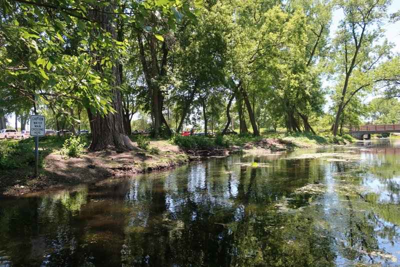
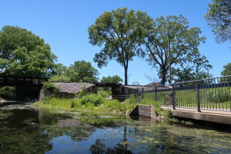
Wingra Creek is primarily a green corridor, with trees and brush blocking views of development in many places. After crossing under John Nolen Drive and the first of three railroad bridges, the creek flows between Goodman and Quann Parks, the latter a grassy off-leash dog park where you may encounter pets hopping in for a swim.
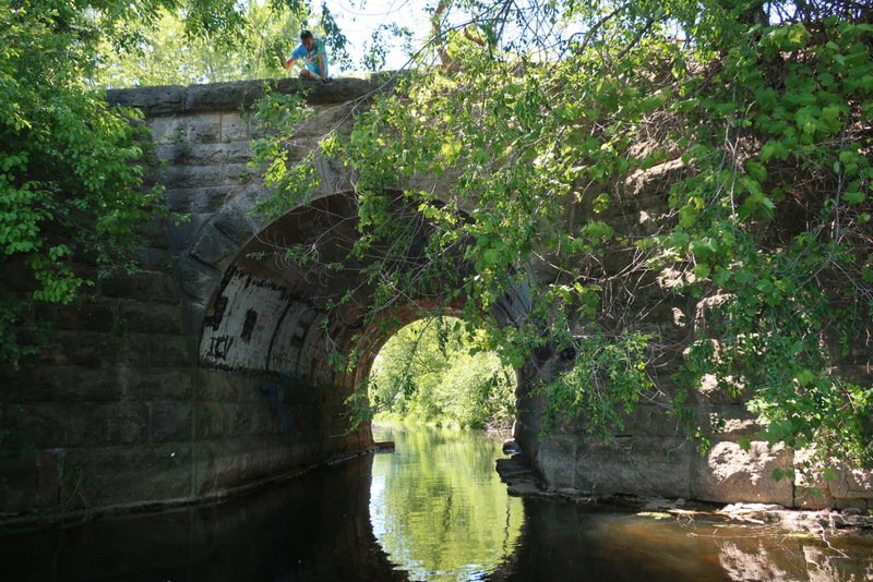
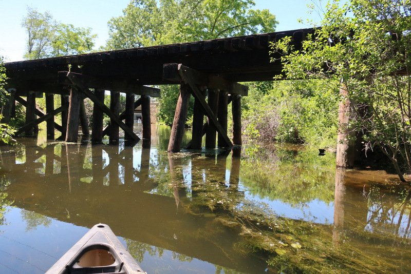
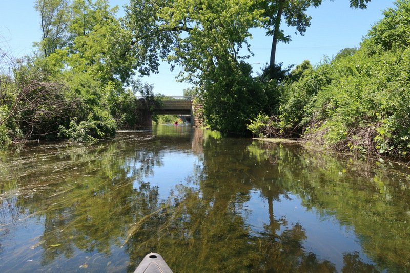
While railroad tracks cross on two trestle bridges, a third rail bridge is supported by a large stone arch/tunnel always good for a photo op. We encountered a couple of bobbers dangling from up top and watched a successful catch rise wriggling in front of our faces from the waters up to a grinning boy above. The occasional turtles seem quite comfortable around paddlers refusing to give up prime perches as we slipped closely past them, and we surprised numerous wary ducks – one of which had temporarily abandoned 8 little ducklings. She came flying upstream as if fired from a circus cannon just as we came upon her chicks in a little cove in the bank. In a rush of flapping wings she planed atop the water on her feet and slid right up a sloping flat rock like water-skiers do at the landing at a water show. Without missing a step, she turned back and scrambled back down into the water to guard the little ones. All in a blink, it was an impressive maneuver.
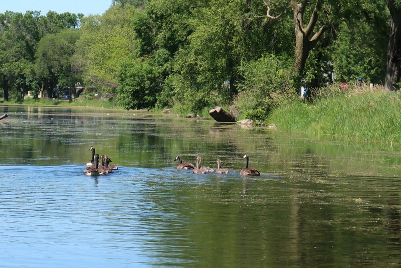
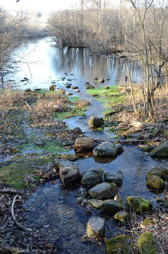
Passing under Fish Hatchery Road the creek takes a turn to the north and puts the protected Gardner Marsh area of the Arboretum on your left and Wingra Drive residences across the street on the right. We encountered an abundance of Canada geese with goslings not quite ready to fly. Some of them hid quietly in the reeds, all those geese frozen, eyes locked on us, nowhere to flee. A posted sign forbids travel deeper into the marsh and its nesting areas without a permit.
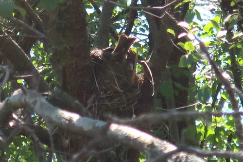
While I was distracted by the staring geese, Tip pointed out a robin’s nest nearly above our heads in the brush. The mother was feeding the babies, their necks backlit and semi-transparent stretching up for the worm. What could have been a perfect photograph. In a time-honored tradition, I cursed myself for not packing the long-lens SLR camera. “Be Prepared.” It’s not just for Boy Scouts.

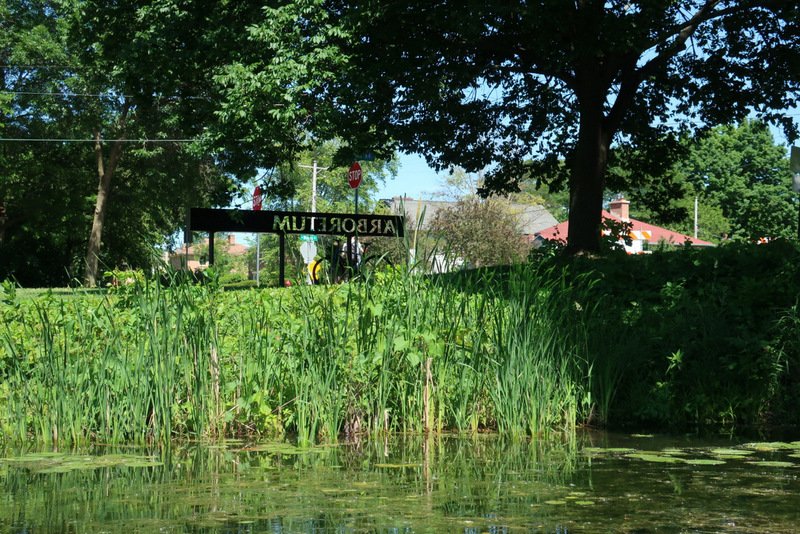
Passing under the stone bridge entrance to Arboretum Drive, we arrived at the widened area beneath the small dam that makes a lake of what was once more of a pond. This can be portaged if you want to explore the lake and its four miles of shoreline, but we saved that for another day. (Consider full-moon paddles here putting in at Wingra Park at the western end of the lake!)

From Olin to the dam at Lake Wingra is just about 2 miles. Our round-trip excursion, with some meandering time and photo stops took a bit more than two hours. Wingra Creek is shallow, and while water clarity wasn’t bad when we went, it can fill up with plant growth and algae, and you might experience some drag here and there. (more photos follow)
For an excellent Madison regional paddling guide, consider Canoeing & Kayaking South Central Wisconsin: 60 Paddling Adventures Within 60 Miles of Madison. For a statewide guide to the best paddling excursions, consider my own book Paddling Wisconsin: A Guide to the State’s Best Paddling Routes (Paddling Series)
. (Contact me directly for signed copies personally deliverable in the Madison area or by USPS at book rate to anywhere else.)
More Photos from Wingra Creek


 ORDER YOUR COPY TODAY!
 ORDER YOUR COPY TODAY!
Thank you for this. I really miss Madison and it made me feel like I was back there again.
I came across this link while reading an article on Chicago hot dogs, which was interesting itself.
Hi Rose,
Glad you liked the article. I’ve moved away a few times over the years, but Madison is definitely home and where the heart is. 🙂 Probably you need to get back and visit more often. 😉
Cheers,
Kevin
See my book of short stories, Stealing Away! (shameless self-promotion)