Camping Michigan
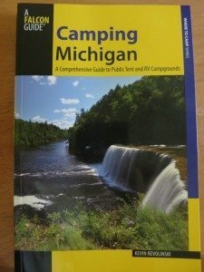 Looking for a great place to pitch a tent or park an RV in the campgrounds of Michigan? Then this book is for you. This is a broad, all-encompassing camping guide to the Great Lakes State, including vital information on all public campgrounds — state, county, city, and state or national forest campgrounds. There are 327 campgrounds in this book.
Camping Michigan divides Michigan into Northwest, Northeast, Southwest, Southeast, and Upper Peninsula, with overview maps for each section. Within each geographical division are subcategories, such as “Detroit Area” or “Ironwood to Copper Harbor.”
Michigan may be more remarkable than most people imagine. Its cup runneth over with natural attractions, bordered as it is by Lakes Superior, Michigan, Huron, and Erie – four of the five Great Lakes. With all that coastline, Michigan has more lighthouses than any other state, by a wide margin.

In some parts of Lower Peninsula, as you leave town on a country highway, you pass a mix of rolling farmland, woods, and more small towns, as if you are never very far from civilization nor from wilderness. In the U.P., however, it seems a town ends and the wilderness runs right up to the shoulder. And that’s all there is for the next hour or so until you find the next community. Backroads may or may not appear on a map and maybe with the correct road name.

There are over 11,000 lakes in Michigan, plus sixteen National Wild and Scenic Rivers, eleven alone in the Upper Peninsula, totaling 625 miles of paddling paradise. Four national forests, Ottawa and Hiawatha in the U.P. and the combined Huron and Manistee in the L.P., have protected massive sections of forests that have either recovered from the lumber days or remain tracts of virgin, old-growth pine and hardwoods. Each peninsula has its own National Lakeshore: Sleeping Bear Dunes along Lake Michigan in the L.P. and Pictured Rocks up north along Lake Superior. Either one should be on the short list of places to see you before you die.
Michigan’s Department of Natural Resources manages over 100 state parks and recreation areas, over 740 boat launches on public lakes and waterways, and nearly 900 miles of hiking trails, 1,145 miles of rail-trails, and over 3,000 miles for ATVs and other off-road vehicles. Double that for the snowmobiles. That’s a lot of protected land preserved for the public and future generations.
Michigan has more than 750 miles of its targeted 1150 miles of the North Country National Scenic Trail, a hiking pathway that extends from New York to North Dakota. Nearly a quarter of the entire trail will be within the two peninsulas of Michigan, and many of its completed segments pass through or close to many of the campgrounds in this book.
Each listing gives all the vital information: location, open times, number of sites with or without hookups, maximum RV lengths, facilities, fees, GPS coordinates and driving directions, contact info, and finally a paragraph or two about the campground and what might (or might not) make it desirable for you.
Each subsection also has an at-a-glance chart comparing campground details to help you narrow your search better.
All of this awaits the camper in Michigan. Inside these pages are 327 campgrounds offering a wide range of comforts from urban parks to the rustic tent-only sites.
Are you more specifically into Tent Camping? Check out Best Tent Camping Wisconsin or Best Tent Camping Michigan.



 ORDER YOUR COPY TODAY!
 ORDER YOUR COPY TODAY!